07.01.13 -
 About eighteen months ago an idea started to form off the back of comments being made on forums about riders who only ever visit trail centres, who miss out on the joys of natural trail riding. We've nothing against trail centres, they're great and we'd love to see more, but there is another side to riding a lot of people don't see. It started us wondering why some people only ride trail centres, is it not having to navigate from a map, is it having facilities at the start and end of a ride, is it wanting to know the route is rideable, is it lack of local knowledge. Well it's more than likely a combination of all these things plus a little bit of fear of the unknown.
At the same time more and more people were asking where else they could ride when they come and visit Lee Quarry. This struck us as odd if you know how much riding there is locally to quarries and further afield, much of it fully legal as well as cheeky. The penny dropped, what we needed to do was plan out some routes using the existing bridleway network, produce some maps, get some way markers on the ground and ideally start them from Futures Park. Trail centre riding away from the trail centre. Hopefully we can get people who wouldn't otherwise venture out to give natural riding a bit of a go without having to spend hours peering at the OS maps.
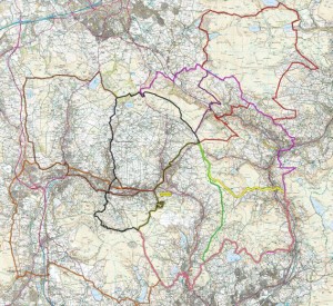
 So we put 8 routes together, varying from 15 to 35 miles in length taking in Rossendale, Calderdale, Burnley and Rochdale. Tony Lund picked up the baton and he and Bill Brady rode the proposed routes to check their viability and legality (nice work if you can get it). The verdict was good although the trails themselves were a little worse for wear in a few places, there's natural riding and then there's a slog fest. Tony than had another good idea. Seeing as we were proposing a number of 'new' routes we should be able to get some funding, and not just for the maps and waymarkers but for trail upgrades. Normally it's all but impossible to secure funding to maintain and repair the existing bridleway network but as these were new routes it was an ideal opportunity to try.
Sometime later and some of the required funding has been secured and work has started on a number of repairs and improvements. The first chunk of work has been completed repairing a washed out ascent up to the Halo panoptican via Duckworth Clough. What was a pretty washed out trail has been made rideable both up and down, and judging from the stream crossing pictures below hasn't ended up fully sanitised. Work is soon to start up on Deerplay Moor for the next set of improvements
Repairs to Duckworth Clough


We're hoping to have all the work done, maps produced and signage in place in time for the opening of the new trail hub in Futures Park (probably early 2014). In the meantime PMBA members can access .gpx files and .pdf maps of the routes below (not a member, sign uponline).
List of routes in .pdf format. The .pdf maps are fairly large files and may take a while to download on a slow connection.
To download the .gpx files right click them and select Save Target As... otherwise your browser will open them as a text file.
| Route Name | Link to .gpx File | Link to .pdf Map | |
| 1 | Rossendale North East Loop | .gpx file | .pdf map |
| 2 | Rossendale North West Loop | .gpx file | .pdf map |
| 3 | Rossendale North East Loop 2 | .gpx file | .pdf map |
| 4 | Rossendale North Loop | .gpx file | .pdf map |
| 5 | Rossendale North Loop 2 | .gpx file | .pdf map |
| 6 | MTL North West | .gpx file | .pdf map |
| 7 | Rossendale South East Loop | .gpx file | .pdf map |
| 8 | MTL South | .gpx file | .pdf map |


Sorry, the comment form is closed at this time.
Sorry, the comment form is closed at this time.